


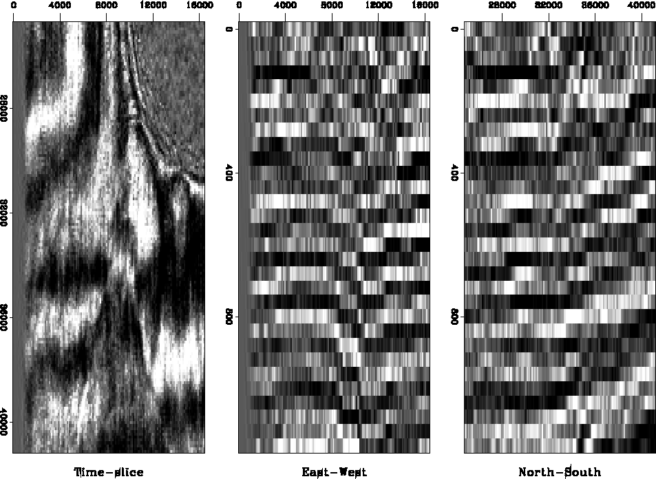
Figure 8 displays a depth migration image of a salt dome. The time slice cuts the almost circular salt dome in the northeastern corner of the figure. Some hardly visible faults radiate from that salt boundary. The image shows a major, wedge-shaped fault system in the southern half of the time-slice. The North-South striking streaks in the time-slice image are an acquisition footprint, a data artifact caused by the field data's recording geometry and binning. In general, the vertical East-West and North-South sections appear to be noisy and discontinuous (middle and right plot of Figure 8). Nevertheless, we discern some steep dipping faults. For example, the reflector depression in the center of the East-West section is bound by the time-slice's southern, wedge-shaped fault system.
 |
As Figure 9 documents, Lomoplan mostly fails to enhance the faults of the salt dome image. The PE filter in the time-slice plane turns the image largely into white noise (top right plot of Figure 9): all events are predictable and therefore removed, except a few minor faults at the salt boundary. The residuals of predicting the low amplitude, incoherent events inside the salt dome are of the same magnitude as the residuals of predicting the high amplitude, but predictable, layered reflectors.
The PE filter in the East-West direction (lower left corner of Figure 9) detects and enhances the acquisition footprint. This North-South striking artifact is unpredictable in the East-West direction and therefore results in large filter residuals. The same North-South streaks are very predictable for filters that predict in the North-South direction, such as the time-slice or North-South residual at the left of Figure 9. Lomoplan could potentially be developed into a method of detecting, estimating, and removing the acquisition footprint of a seismic image after its migration.
The vertical filters (bottom plots of Figure 9) detect the edge of the salt dome. In contrast to the time-slice predictions, the residuals that spring from the salt events are much smaller than the residuals that spring from the surrounding layered reflectors. Unfortunately, we cannot detect the major wedge-shaped fault system in the Lomoplan outputs. These faults were predicted by the various PE filters and were consequently removed. An alternative explanation postulates that the filtered image contains the expected fault residuals, but that other unpredictable events, such as the streaks due to the acquisition footprint or discontinuities between time-slices, overwhelm the fault residuals.
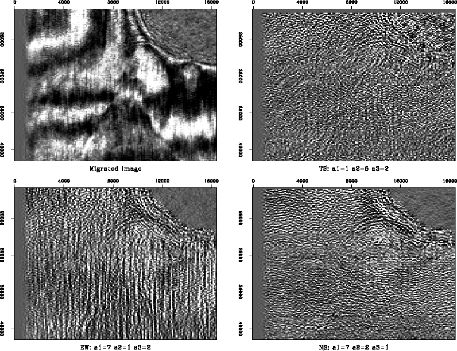 |
Figure 10 shows the result of applying a single 3-D volume PE filter, rather than the combinations of planar filters, to the salt dome image. The filter does not exclusively reject a local plane reflector component As a matter of fact, in the salt dome example, even our modestly sized filters manage to predict and remove all events of interest; only the edge of the salt dome remains a distinctive boundary.
 |


