


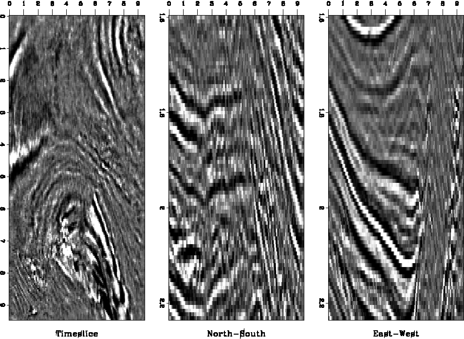
Figure 11 images the top of a steep salt anticline. A major normal fault intersects the anticline from southwest to northeast and places the younger rock of the northwestern tip of the anticline next to older sediments of the southeastern anticline part. We want to enhance this major fault in the migrated image and possibly discover additional discontinuities.
 |
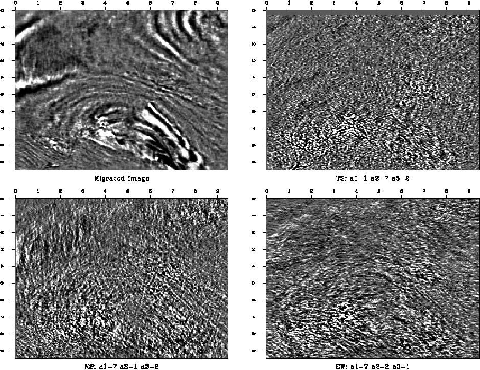
As Figure 12 illustrates, Lomoplan removes the smoothly varying part of the wave field but it does not succeed in enhancing the major fault. It also fails to remove the steeply dipping beds in the South-East corner and the strongly curved and disturbed area, where the diagonal normal fault intersects the southern flank of the anticline. Furthermore, the time-slice predictions fail to predict the curved events at the tip of the anticline at the center of the plot. Lomoplan fails to generate an easily interpreted subsurface map.
 |
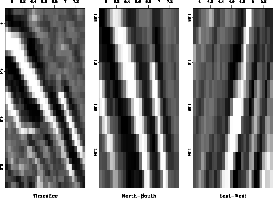
To understand better why Lomoplan fails to delineate the major fault, we decided to isolate a single subcube at the intersection of the fault and the northern anticline flank (see Figure 13). Since the subcube's dips are almost stationary over a wide range of cube sizes, we use a single PE filter for the entire subcube. The fault (northeastern trend) and the anticline flank (northwestern trend) cross at the center of the plot.
 |


The residual plots do not depict the strong enhancement of the fault that we initially expected. None of the Lomoplan residual images improves the interpretability compared to the original data.
Inspecting the data closely, we found that the fault is not a sudden, unpredictable discontinuity, but rather a zone of comparatively rapid amplitude change. However, the fault is several samples wide and rather smooth. Furthermore, the displacement of the sediments is about one wavelength of the sedimentary sequence, which gives a false impression of continuity across the fault zone. For smaller subcubes, the spatial extent of the fault zone and the coincidental continuity of sediments across the fault make it even more difficult for the PE filter to detect the fault location.
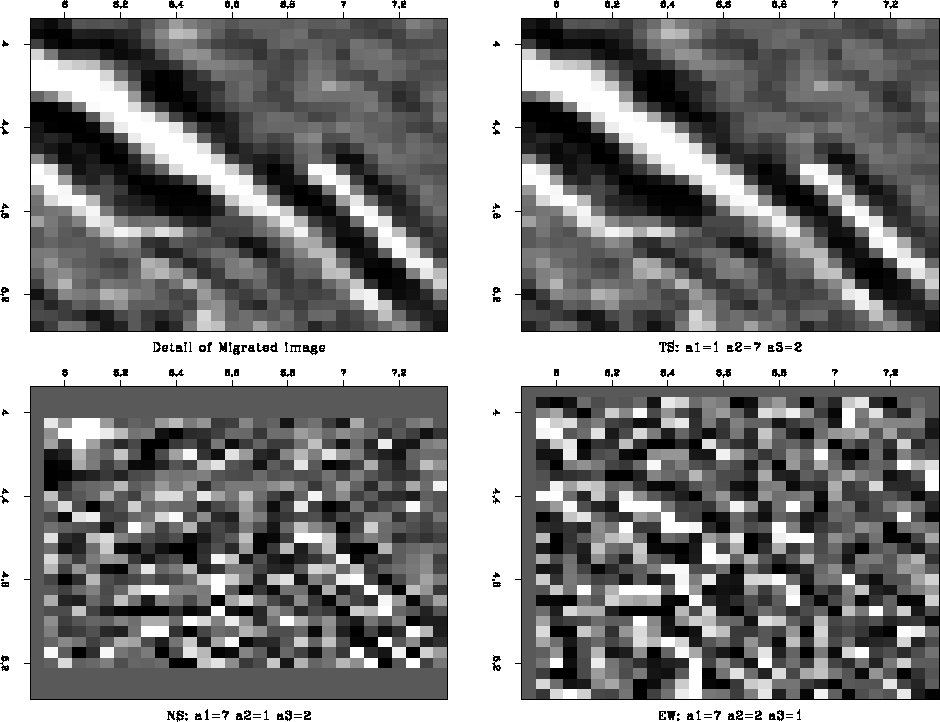 |
The zero valued regions at the edge of Figure 14 result from the particular shape of the PE filters. Since we choose to convolve the filter with known data, the filter's output is smaller than its input, as Figure 15 illustrates. These zero edges are not visible in the final, merged image (such as Figure 12), since the algorithm that merges the subcubes weights the overlapping volumes and their zero-valued edge regions appropriately.
|
rabdomain
Figure 15 Domain of inputs and outputs of a two-dimensional prediction-error filter. | 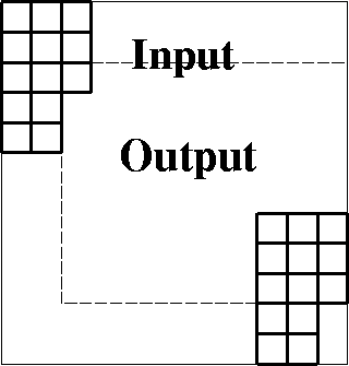 |