


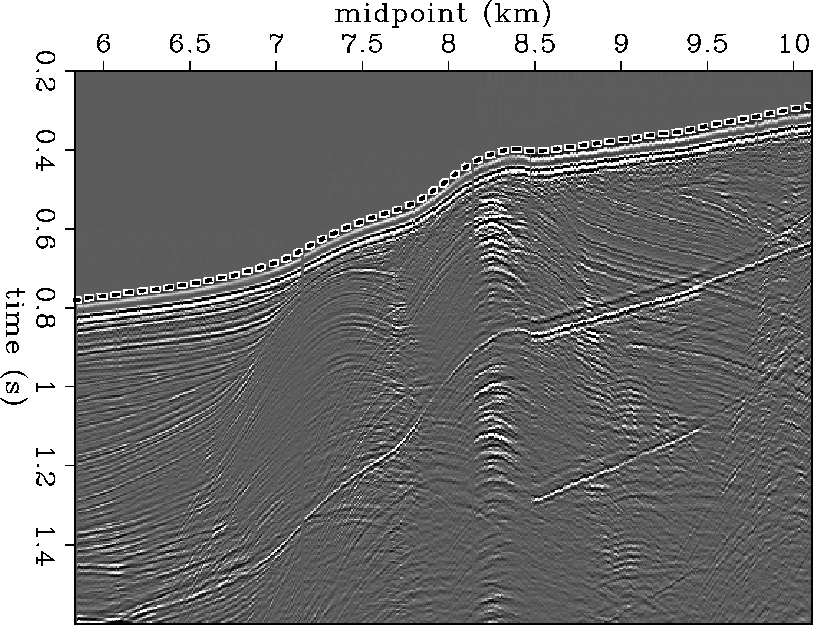
The near-offset section of a high quality marine data set is displayed in Figure 2. This is the offshore southern California data used by Fowler 1988. The complex structure in the center of the line causes prominent diffraction events. The dashed line in Figure 2 represents a datum along the ocean floor defined by the first break picks. The near-offset is 66 m so I treat the data as if it were zero-offset and input it to the datuming algorithm.
 |

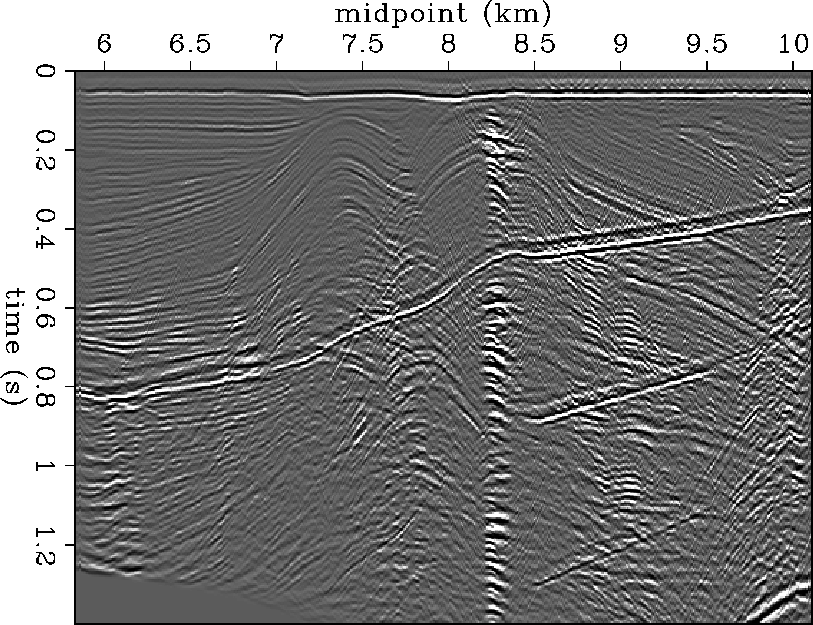
The downward continued data are displayed in Figure 3. The diffractions have now partially collapsed but they look somewhat deformed due to the dipping and undulating seafloor datum. The prominent seafloor multiple is now the same shape and at the same time delay as the seafloor primary of Figure 2. This corresponds to an arrival reflecting from the ocean surface. The lower left portion of Figure 3 contains no events below about 1.2 s because the data input to the datuming program only extend to 2 s and the seafloor in this region is at about 0.8 s. The downward continued data appear to have a lower frequency content than the original data.
Yilmaz and Lucas 1986 and Berryhill 1986 perform downward continuation with the water velocity as I have done here in regions with severe water bottom topography and high velocity contrast between the water and the sediments. They then upward continue the data using the sediment velocity in order to eliminate distortions due to ray-bending. For the data set used here the velocity contrast between the water and the sediments is small so this procedure is not applied.
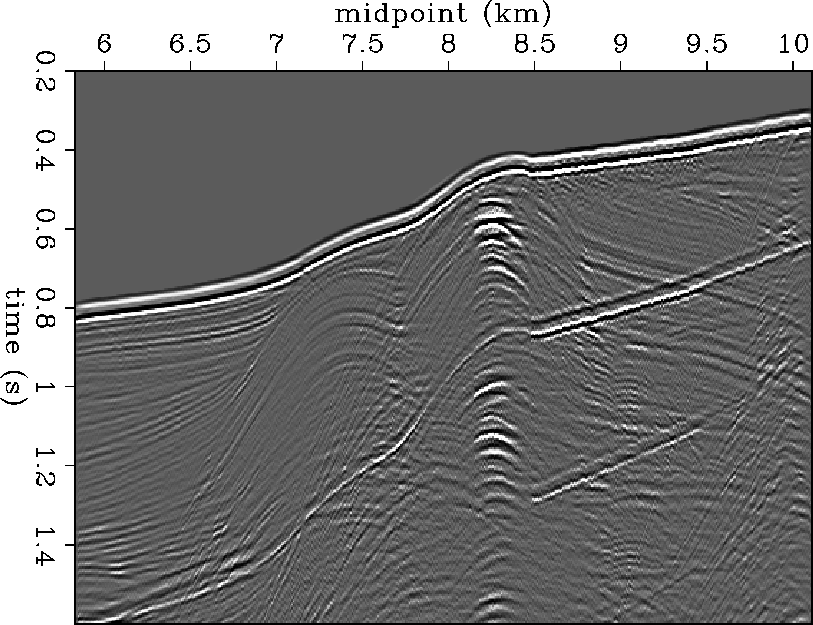
Except for the event due to the surface reflection, the downward continued data may be thought of as being similar to land data acquired on an irregular surface. The distortion of the diffractions would be the same in both cases. The process of upward continuing the data back to sea level is analogous to upward continuing land data to some arbitrary datum above the highest topographic relief. Figure 4 shows the data which have been continued back up to the surface from the ocean bottom. The partially collapsed and distorted diffractions have been faithfully restored to the same state as in Figure 2; however, Figure 4 has lower frequency content than the original data. This may be due to effects of the anti-aliasing.
 |
 |