


The Laramie broad-band array which consisted of 30 CMG-40T three-component seismometers spaced between one and two kilometers apart, recorded continuously for 8 months in 2000-2001. The focus of the project was to image the Proterozoic Cheyenne Suture representing a nearly 2 billion years old continental collision. The array trending northwest-southeast, straddled the northern edge of the suture.
|
map
Figure 9 The X's represent the stations associated with the Laramie array. Note large thickness of the Laramie basin shown by the contours. The sampling area of the teleseismic dataset at 40 km depth is shown as the gray ellipsoidal area. The Cheyenne belt suture (CB) surface expression is shows as the thick white line (dotted where inferred). Major NE-trending shear zones are marked as thick dark lines and denoted as: FM, Farwell Mountain; SG, Skin Creek Gulch; IC, Illinois Creek. Surrounding mountains that expose the basement are labeled as: SM, Sierra Madre; MB, Medicine Bow; LM, Laramie Mts. Image modified from Dueker and Yuan, 2004. | 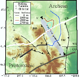 |

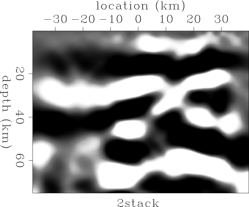
Dueker and Yuan (2004) produced an image using receiver function analysis where the vertical component is treated as the source function and deconvolved from the radial component. Application of a linear moveout operator to the processed seismograms followed by common conversion point stacking produced the image shown in Figure 10. Important features of this image include the mid-crustal reflector near 20 km depth and the Moho which is interpreted to be near 40 km depth across the line. A second feature dips down below the Moho to the north to a depth of 60 km. Dueker and Yuan (2004) interpret this feature to be a sliver of crust thrust underneath the Wyoming craton during collision.
We have created a migrated image of the forward-scattered P-to-S phase using the same data for comparison to the receiver function image. The results are consistent in many parts of the image including the feature near 20 km depth and the dipping feature between 40 and 60 km depth. However the feature interpreted to be the Moho in the north is absent from our image casting doubt on the previous interpretation. The migrated image appears to be very noisy and low frequency. A different source representation, perhaps as a band limited plane wave, and the incorporation of backscattered phases would improve the image.
 |
 |