Next: Calibration by a flat
Up: Application to 3D land
Previous: Application to 3D land
The original dataset is considered oversampled. Therefore I decimated
the survey to simulate a realistic acquisition geometry.
The shot lines from the original survey were spaced at 140 meters,
whereas in the decimated experiment they alternate between 140
and 280 m for an average spacing of 210 m.
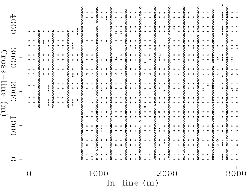
I also extracted every third receiver line to simulate a line spacing
of 210 meters instead of the original 70 meter spacing.
Figure survey210 shows the layout of the source and receiver
lines for the 210 meter grid.
To make the data handling and processing quicker,
I only considered the central part of the survey which included
the river channels.
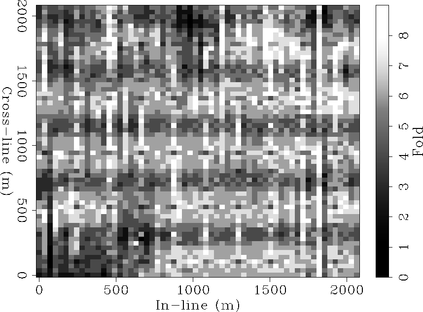
The model is 2.1 km long and 2.1 km wide sampled at 17.5 meter.
I extracted a subset of 20,000 traces whose source-receiver offset
is between 600 and 1,000 meters and azimuth between -45o and 45o.
Figure fold shows the fold distribution
for the 3D subset binned at the nominal CMP spacing,
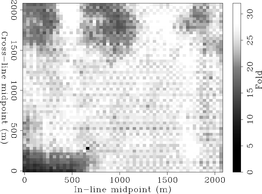
whereas Figure fold-full represents a fold chart for the same offset and
azimuth range from the original survey.
There is a fundamental problem with
the the sub-sampled subset; variations in fold between
different bins vary substantially
from 0 to a maximum of 10.
If not properly accounted for, they can distort the quality of
the final image.
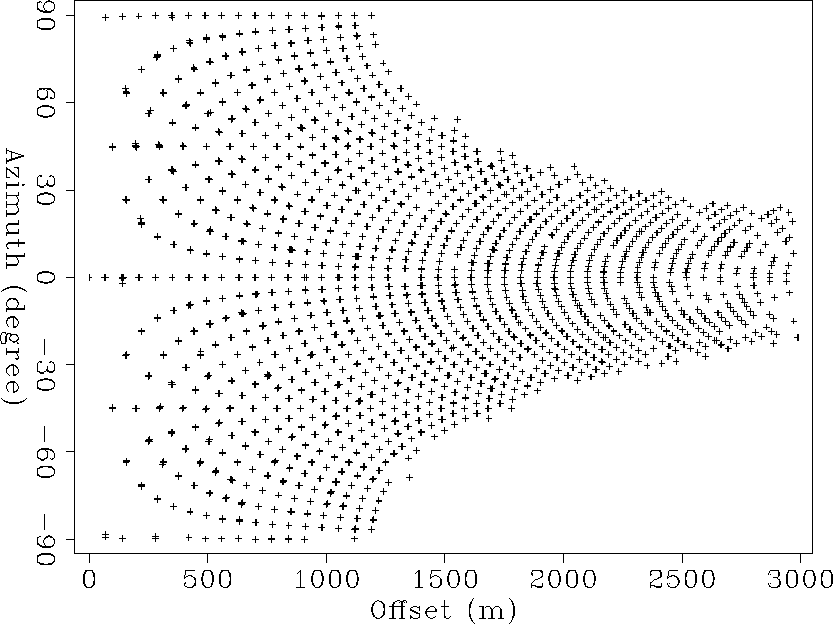
azim-offset
Figure 3 Azimuth and offset distribution of the cross-spread survey.


 survey210
Figure 4 Cross-spread acquisition geometry with grid spacing of 210 m.
The stars and circles indicate the
source and receiver locations respectively.
fold
Figure 5 Fold diagram for the 3-D subset from the decimated survey.
fold-full
Figure 6 Fold diagram for the 3-D subset from the over-sampled survey
Next: Calibration by a flat
Up: Application to 3D land
Previous: Application to 3D land
Stanford Exploration Project
1/18/2001