


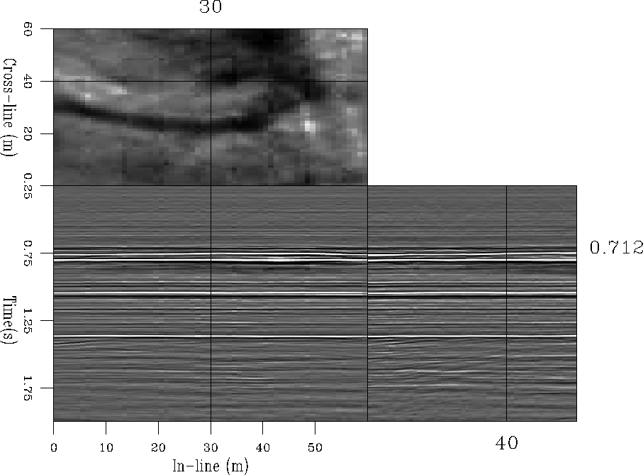
This section presents the results of applying the true-amplitude sequence to a land data set recorded in the Shorncliff region of Alberta, Canada. The quality of the data is very high as shown in Figure stack which represents an NMO-Stack of the 3D survey. The dominant geology of the area is flat. The objective target is quite shallow (approximately .71 seconds), where some channels cross the section in the in-line direction. Previous studies of the dataset focused on time imaging techniques i.e, DMO processing and inversion to zero offset Ronen and Goodway (1998). This chapter addresses the problems related to prestack depth imaging and the effects of irregular sampling on the image quality. The data set is a valuable test case because of the shallow depth of the target zone which makes it sensitive to acquisition geometries.
 |


The survey was designed with the aim of obtaining a high fold coverage for a good quality final stack. The full-stack image can then be used to assess the quality of partial stacks, or, to compare with images obtained by simulating more economic acquisition geometries. The data were acquired using a cross-spread geometry, which provides a wide range of azimuths at near offsets but a narrower range at far offsets (Figure azim-offset). The full survey consisted of 1.4 million tracing with maximum offset of 3 km. The shot and receiver spacing is 70 meters for a nominal CMP-spacing of 35 meters in both in-line and cross-line directions.