


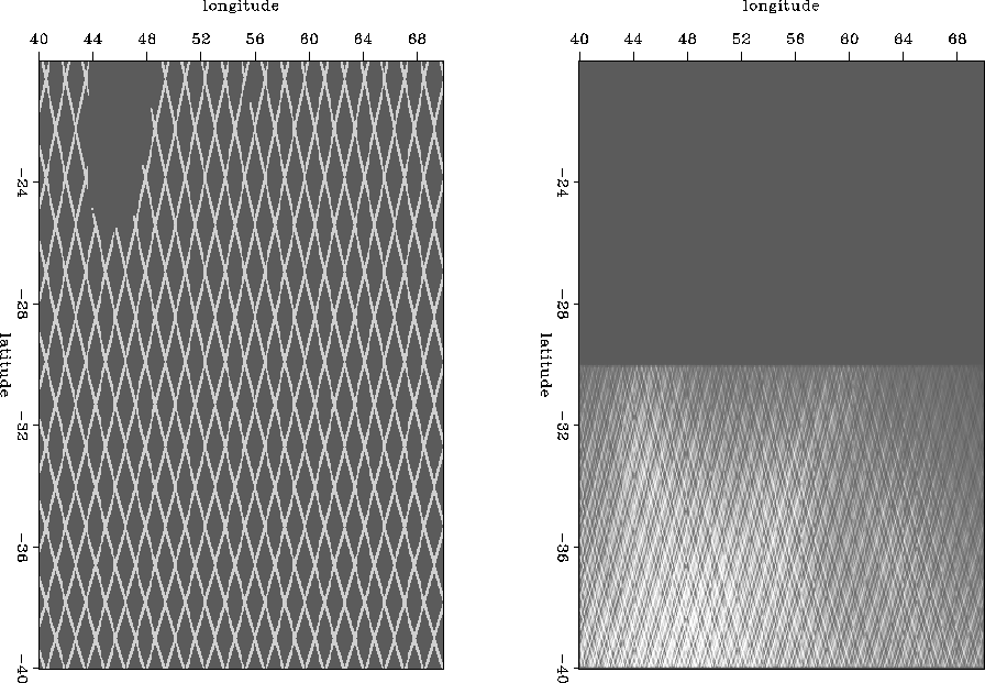
The satellite data consists of four different sets, each of which is a one-dimensional array of tracks connected end to end. There are two sets of sparsely sampled tracks, one north flying and one south flying. There are also two sets of densely sampled tracks, again one north flying (ascending) and the other south flying (descending). The sparse tracks cover the same region as the dense tracks plus a region of equal size to the north. Figure 1 shows the geometry of the data separated into sparse tracks and dense tracks.
 |


Using a weighted least squares approach, Ecker and Berlioux (1995) imaged the dense southern region. They used a derivative along the data tracks to remove the shifts between each pass. Some work has been done been done to image the sparse tracks. Lomask (1998) estimated 2D prediction error filters (PEFs) on the dense region and applied them in regularization operators on the sparse region. In this paper, I review how inversion is used to image the Madagascar data. Also, I describe methods for estimating and applying PEFs on sparse and irregular data.