BAGS Seminar
Targeted Use of Airborne Electromagnetic Method for Groundwater Applications
Example: Central Valley of California
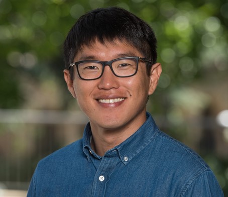
Dr. Seogi Kang
June 30th, 2022, 5 PM
In-person: Room 220, McCone Hall, UC Berkeley Campus
Simultaneously broadcast as a Webinar (see member email for details)
| Abstract: Airborne electromagnetic (AEM) method provides an imaging capability to rapidly map out resistivity structure of the subsurface in a large area. With a close connection between resistivity and hydrogeology (e.g., sediment type, water quality), the AEM method can provide a complementary approach with traditional well-based approaches for imaging hydrogeology of the subsurface a fundamental knowledge required for groundwater science & management. However, the AEM method only provides indirect information about hydrogeology (i.e., resistivity) and further it suffers from the limited resolution generally decreasing with depth. These disadvantages create inaccuracy in a derived hydrogeologic model and associated interpretations. In this presentation, I demonstrated how ''targeted approach'', which focuses on specific issues of groundwater applications and incorporates other available data or existing geologic knowledge into the imaging process can improve the derived hydrogeologic model and associated interpretations. Working with two AEM data sets obtained in the Central Valley of California one of the most productive farmland in the world, we addressed specific groundwater issues: 1) Northern part of the valley: Vertical connectivity of the aquifer system and 2) Southern part of the valley: Imaging large-scale structure. |
Speaker Bio:
 |
Dr. Kang completed his PhD in Geophysics at University of British Columbia, Canada, in 2018. His thesis work focused on computational electromagnetics and its application to mining problems. Currently, he is a Postdoctoral Researcher in the Geophysics Department at Stanford. His research focus is on maximizing the value of electromagnetic methods for groundwater science and management in California, USA. He is a co-creator of an open-source geophysical software, SimPEG. |