|
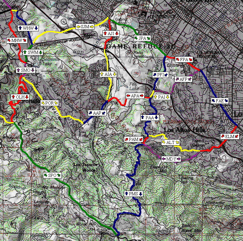
This Ride Calculator below allows you (more likely me) to construct a variety of different
Stanford-area road rides of arbitrary length and elevation gain. Refer to the graphical map below and
construct your desired run by clicking on individual segments (described in the table below
and also when you put your mouse over the arrows) in your desired direction of travel. When you are done, notice
that the "Your ride" box has a comma-delimited list of the segments. Click "Compute Ride Statistics" to compute
total elevation change and the distance along your ride. You can cut-and-paste from the ride summary window
and save your ride as a text file for future reference.
The climb and descent will not generally be the same on a loop ride because segment elevation
changes are rounded to the nearest 10 feet.
|