


The most common form of datuming is to perform static shifts of data traces. This is adequate for regions where the near surface raypaths are nearly vertical and where the shifts are small. The static shift method is commonly applied to correct for near surface velocity variations due to weathering layers and for topographic effects. When static shifts are large and the assumption of vertical raypaths is not valid, the wave field is distorted by the static shift so that velocity analysis, migration and any other wave equation based processing is severely degraded Bevc (1992a). The problem with many land data sets is that the topography distorts the data so much that it is not possible to pick coherent reflection events or to estimate velocity. In these situations wave equation datuming is necessary.
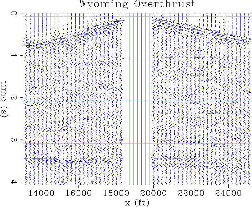
A shot gather from the Wyoming overthrust data set is shown in Figure 3. This data suffers from statics problems due to lateral variations in the near surface low velocity layer and due to topography. On the right side of the gather, the first arrivals form a straight line and the reflections are nearly hyperbolic. The left side of the gather is distorted by the topography and the near-surface velocity structure.
 |


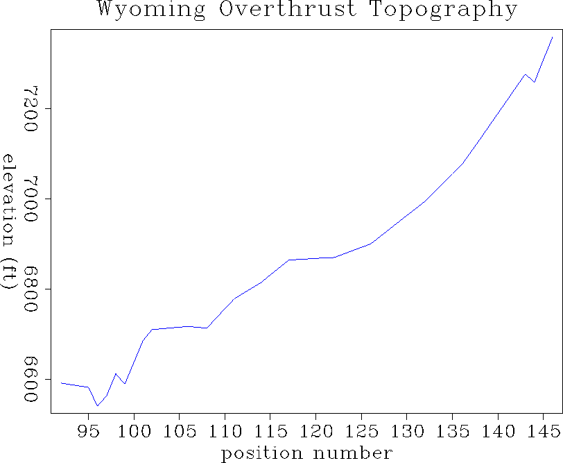
The topography along the shot profile is displayed in Figure 4. The first arrivals are delayed in the region with lower topography. This region must therefore have a thick low velocity near surface layer. The portion of the gather with higher elevation corresponds to faster near surface velocity.
 |
If the near surface velocity structure is known, data can be downward continued through the near surface velocity structure to some lower datum. For most land data, the near surface velocity is not known. One method of eliminating distortions due to topography is to upward continue the data to an arbitrary datum above the highest topography. This is analogous to upward continuing marine data from the water bottom back to the original acquisition surface in marine layer replacement applications. The proper velocity to use for upward continuation should be close to the near surface velocity. Once the data have been upward continued to a higher datum, conventional velocity analysis can be performed. The result of velocity analysis, stacking, and migration after wave equation datuming should be superior to the result after static shift.
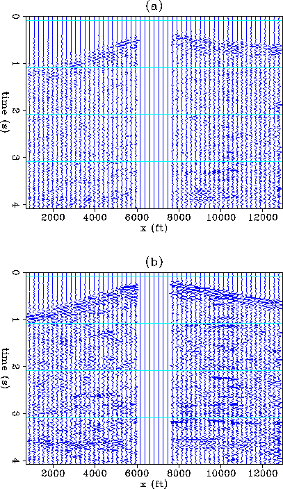
The result of upward continuing the shot of Figure 3 is shown in Figures 5 and 6. Many different velocities were used for the upward continuation but only four panels of the resulting data cube are shown here.
In Figure 5 the data are upward continued with relatively low velocities of 2000 ft/s and 5733 ft/s. Evidently these velocities are too low because the left and right side of the gather are not symmetric: The first arrivals on the left side are delayed more than they were in the original data (Figure 3). The datuming velocity of 2000 ft/s is certainly to slow since the reflection event which was originally at 3.5 s has been delayed substantially in Figure 5a.
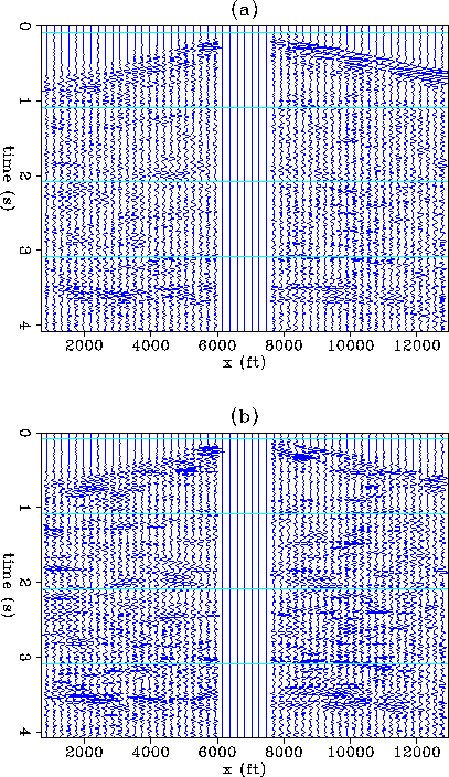
The gather looks more symmetric when higher datuming velocities of 10,000 ft/s and 20,000 ft/s are used (Figure 6). These higher velocities are close to the medium velocity for the portion of the gather which is recorded at the higher elevations. The deep reflector which was initially at 3.5 s is unraveled when the data are redatumed with the higher velocities. There are also other events at earlier times which become visible as coherent reflections with hyperbolic trajectories. These are especially evident in the last frame of the movie where the data have been extrapolated upward with a velocity of 20,000 ft/s (Figure 6b).
 |
 |
Although only one shot gather is datumed here, the results are promising, since the algorithm has the desired effect of unraveling the effects of irregular topography. Because wave equation datuming is superior to static shift when near surface raypaths are not vertical, upward continuing all the shot and receiver gathers should result in an improved processing flow for data with severe topography and statics.