|
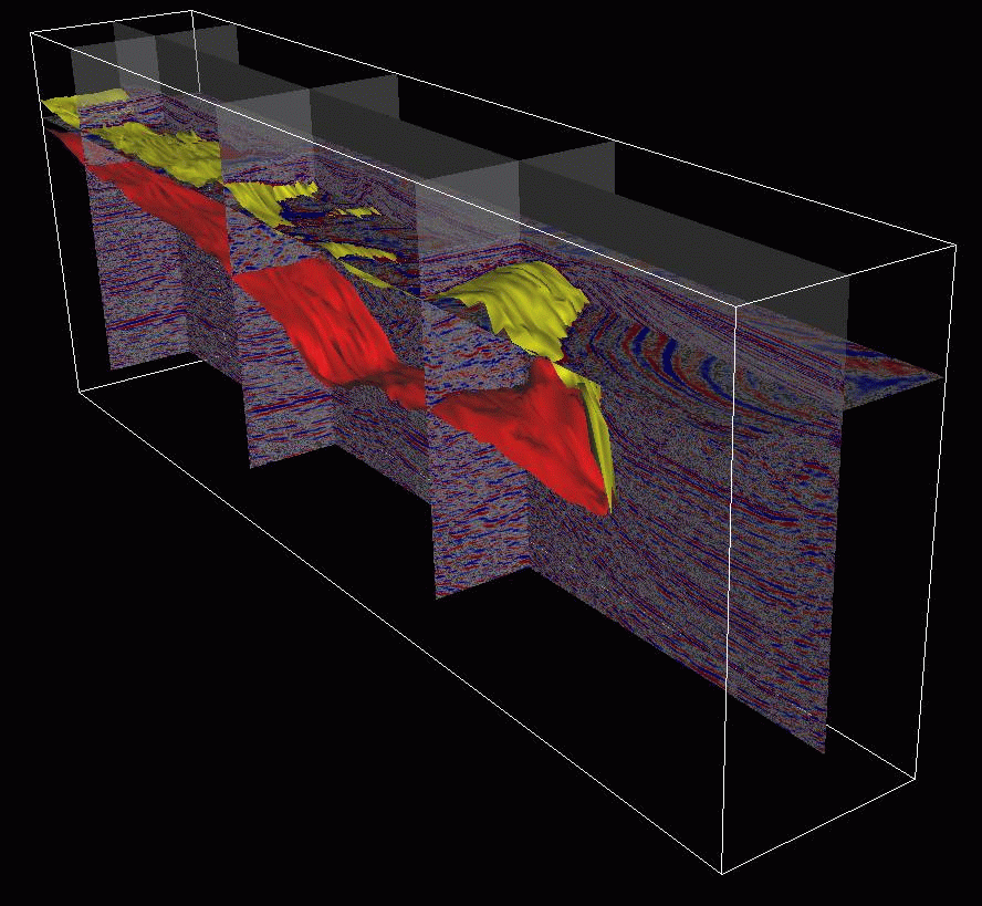
| 3-D rendering of seismic image and salt body |
The advent of 3-D seismic has transformed the upstream oil industry because it enabled exploration in areas with complex structures lying below complex overburden. An important example is sub-salt exploration. Salt bodies, like the one shown in the image on the right, cause severe distortions in the propagating wavefield. The sedimentary traps below the salt body can be properly imaged only if the recorded data are numerically backpropagated in the subsurface honoring the full 3-D nature of the field experiment.

|
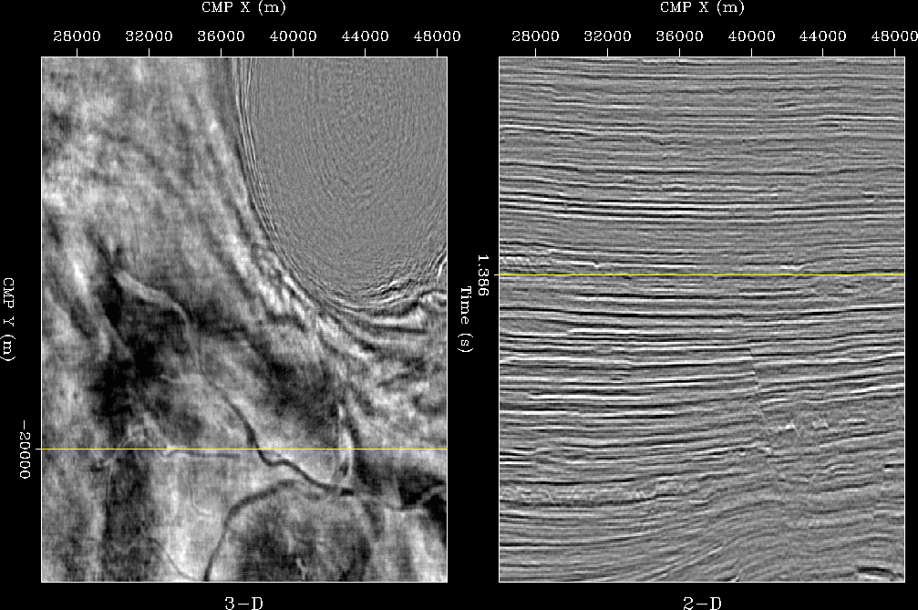
| Timeslice and vertical section of a 3-D data set |
Seismic processing of 3-D data is inherently different from 2-D processing. The differences begin with data acquisition: 3-D data geometries are considerably more irregular than 2-D geometries. Furthermore, 3-D acquisition geometries are never ``complete'' because sources and receivers are never laid out in dense areal arrays covering the surface above the target. These fundamental differences, together with the increased dimensionality of the problem, strongly influence the methods applied to process, visualize, and interpret the final images. Most 3-D imaging methods and algorithms cannot be derived from their 2-D equivalent ``just by adding a couple of dimensions to the 2-D equations''. This book introduces seismic imaging from the 3-D perspective, starting from a 3-D Earth model. However, because the reader is likely to be familiar and comfortable already with 2-D processing methods, whenever useful I discuss the connections between 3-D algorithms and the corresponding 2-D algorithms.
The book covers all the important aspects of 3-D imaging. It links the migration methods with data acquisition and velocity estimation, because in practice they are inextricably intertwined. Data geometries strongly influence the choice of 3-D imaging methods. At the beginning of the book, ( Chapter 1 ) I present the most common acquisition geometries, and continue to discuss the relationships between imaging methods and acquisition geometries throughout the text. The imaging algorithms are introduced assuming regular and adequate sampling. However, two chapters ( Chapters 8 and 9 ) explicitly discuss the problems and solutions related to irregular and inadequate spatial sampling of the data.
Velocity estimation is an integral component of the imaging process. On one hand, to create a good image we need to provide a good velocity function to the migration process. On the other hand, in complex areas velocity is estimated by iterative migration and velocity updating. Migration methods are presented first, (Chapters 1-9) because they provide the basic understanding necessary to discuss the velocity updating process (Chapters 10-12).
Seismic imaging algorithms can be divided in two broad categories: integral methods (e.g. Kirchhoff methods) and wavefield-continuation methods. Integral methods can be described by simple geometrical objects such as rays and summation surfaces. They are thus more easily understood by intuition than the wavefield-continuation methods. My introduction of the basic principles of 3-D imaging ( Chapters 2 and 3 ) exploits the didactical advantages of integral methods. However, wavefield-continuation methods can yield more accurate images of complex subsurface structures. The book introduces wavefield-continuation imaging methods by leveraging the intuitive understanding gained during the study of integral methods ( Chapter 4 ). Wavefield-continuation methods are the subject of my on-going research and that of my graduate students. Therefore, the wavefield-continuation methods described are more advanced, though less well established, than the corresponding integral methods.
Seismic imaging technology is data driven, and the book contains many examples of applications. The examples both illustrate the rationale of the methods, and expose their strengths and weaknesses. The data examples are drawn both from real data sets and from a realistic synthetic data set: the SEG-EAGE salt data set. This data set is distributed freely and is widely used in the geophysical community. For the reader's convenience a subset of this data set (known as C3 Narrow-Azimuth) will be contained in the DVD included with the hard-copy of the book. Appendix 2 briefly describes this data set.
The software needed to produce all the examples will be also freely available once the book is published. A reader with the necessary computer equipment (a powerful Unix workstation) and the patience to wait for weeks-long runs, should be able to reproduce the images obtained from the the SEG-EAGE salt data set. Appendix 1 describes the foundations of Seplib3D, the main software package that is needed to generate most of the results shown in the text.
The book starts from the introduction of the basic concepts and methods in 3-D seismic imaging. To follow the first part of the book, the reader is only expected to have an elementary understanding of 2-D seismic methods. The book can thus be used for teaching a first-level graduate class as well as a short course for professionals. The second part of the book covers more complex topics and recent research advances. This material can be used in an advanced graduate class in seismic imaging.. To facilitate the teaching of the material in this book, the attached DVD includes a document in PDF format that has been specifically formatted to be electronically projected during a lecture. Many figures in this electronic document can be animated, thus providing a more cogent illustration of the concepts described in the text.
