


![[*]](http://sepwww.stanford.edu/latex2html/cross_ref_motif.gif) is a field 3D data cube from the Gulf of Mexico provided by Chevron. It consists of structurally simple horizons that have been warped up around a salt peircement. Numerous channels can be seen in time slices. In the time slice at the top of Figure , a channel can be seen snaking across the south side.
is a field 3D data cube from the Gulf of Mexico provided by Chevron. It consists of structurally simple horizons that have been warped up around a salt peircement. Numerous channels can be seen in time slices. In the time slice at the top of Figure , a channel can be seen snaking across the south side.
 |


Figure shows the flattened output of the data in Figure . The seismic cube has been converted from a stack of time slices to a stack of horizon slices. Notice that the low frequency banding present in the unflattened data is no longer present in the flattened data. This is because horizons are no longer cutting across the image. Several channels are now easily viewed on the horizon slice. Also, notice the salt dome appears to be more localized in Figure .
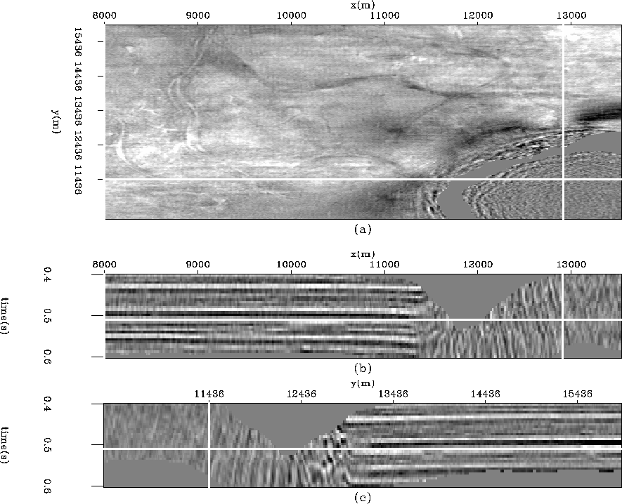 |
. The top panel is now a horizon slice displaying several channels. The vertical sections illustrate that the cube is flat in both the x and y directions. (a) The horizon slice at time=
Figure displays three horizons overlain on the original data in Figure . The horizons track the reflectors on the flanks of the salt well as expected. Within the salt, the horizons gradually get off their respective reflector events as the estimated dip becomes very inaccurate. The time slice at the top displays the swath of a tracked horizon.
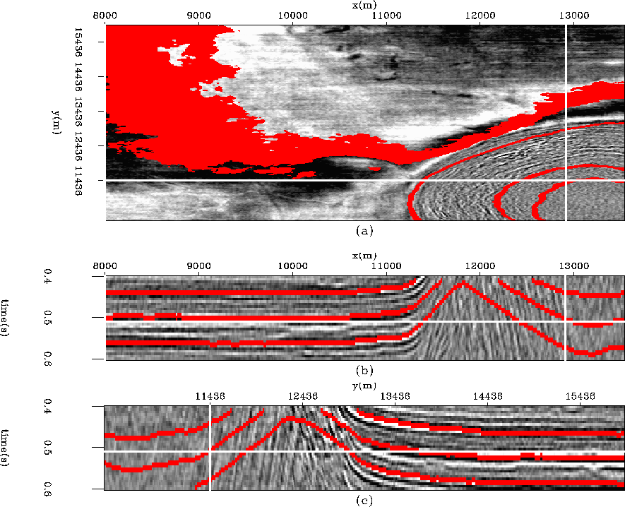 |
. It successfully tracks the horizons even to the considerably steep dips leading into the salt peircement. (a) The time slice at time=