


Figure ![[*]](http://sepwww.stanford.edu/latex2html/cross_ref_motif.gif) is a real 3D data cube from the Gulf of Mexico provided by Chevron. It consists of almost flat horizons that have been warped up around a salt piercement. Numerous channels can be seen in time slices. In the time slice at the top of Figure a channel can be seen snaking across along the south side.
is a real 3D data cube from the Gulf of Mexico provided by Chevron. It consists of almost flat horizons that have been warped up around a salt piercement. Numerous channels can be seen in time slices. In the time slice at the top of Figure a channel can be seen snaking across along the south side.
Figure shows the flatted output of the Chevron data. Notice that the horizons are flatter than those of Figure .
Figure is an unflattened time slice from the Chevron data and Figure is a flattened time slice (horizon slice) from approximately the same place in the data. Notice Figure does not have the low frequency banding that Figure has. Also notice that the salt dome appears to be smaller in Figure . This indicates that the layers warped up by the salt have been made flatter.
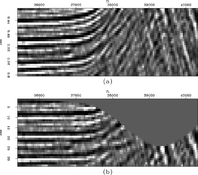
Figure compares an east-west section from the Chevron data to its flattened counterpart. The left side of the flattened section is clearly flatter that the input above. However, notice that the flattened image doesn't do a great job where the beds are dipping up steeply. This could be a result of poor dip estimation and definitely warrants further investigation.
 |


