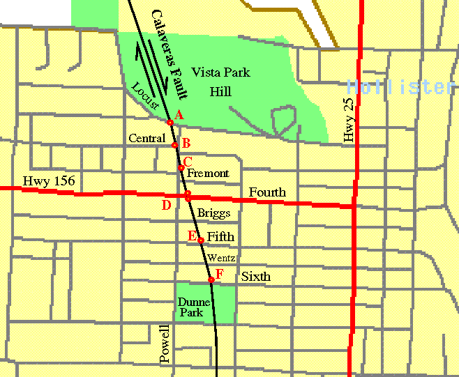
This map is courtesy of the US Census bureau Tiger map server. Click on the map to bring up the (unannotated) original under their map ``browser''. From there try interactively zooming out to see this map ``in context''.
The red letters indicate the various stops on the walking tour. At each stop, a subset of this map will be shown at four times this scale. On those close-up maps, the white numbers on blue dots show where the corresponding photo was taken from; the blue arrows show the direction the camera was pointed. If there is no arrow, the camera was pointed down!
If I skip a number it's because it nearly repeats one that is shown.
On the map above, the black arrows indicate the sense of the fault's motion. The fault moves like your hands do when you rub them against each other. The coast of California is not ``falling off''; it is moving North laterally, in splinters! It's not just the coast, either: although most of the Northward motion does happen West of the San Andreas, the influence of the Pacific Plate dragging the Western edge of the continent North can be felt all the way East to the Wasatch fault in central Utah. (The Wasatch fault runs through Salt Lake City.)