Example Maps

3-D topo map
|

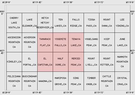
Vicinity map
| Yosemite Valley
| 15 x 21.5 minute composite map of the Yosemite Valley region, Yosemite NP, USA.
The valley, originally carved into the granites of the Yosemite batholith by
the Merced River, then further sculpted by glaciers, boasts shear walls of
nearly 1000m in places.
|

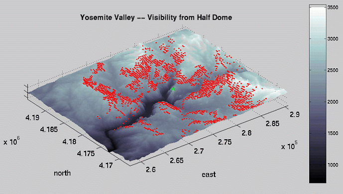
3-D Half Dome
Visibility map
|

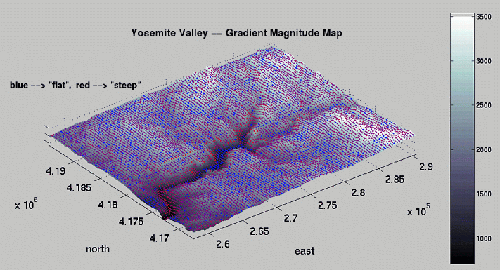
Relative
Steepness map
|
|

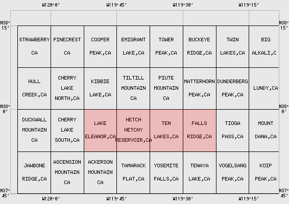
3-D topo map
|

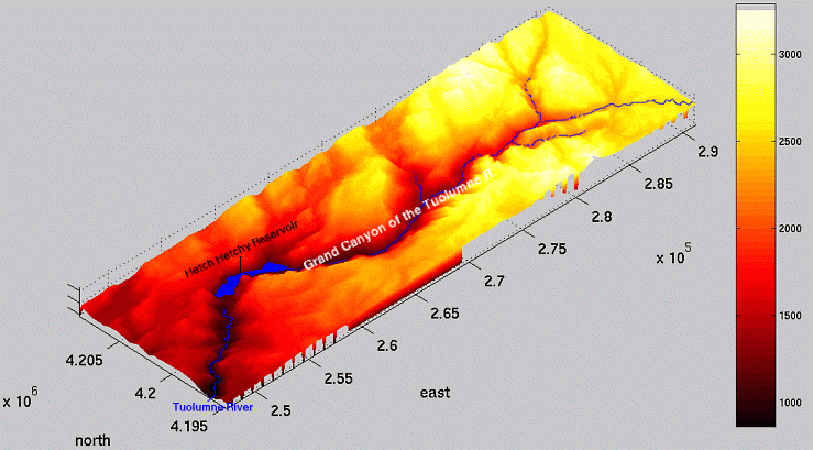
Vicinity map
| Grand Canyon of the Tuolumne River
| 7.5 x 30 minute composite map of the Grand Canyon of the Tuolumne River, Yosemite NP, USA.
Like its more renowned cousin to the south, Yosemite Valley, this valley was originally carved
into the granite by glacial erosion. At its deepest, the canyon is 1000m high, but much thinner
than Yosemite Valley. The Tuolumne River was dammed soon after 1900 to create Hetch Hetchy
Reservoir, which supplies water to San Francisco (look for the aqueduct from Hwy. 120). Although
the damming ruined the splendors of the valley, which were reputed to closely rival Yosemite Valley's,
it created some very interesting scenery. I recommend hiking here during busy times.
|
|

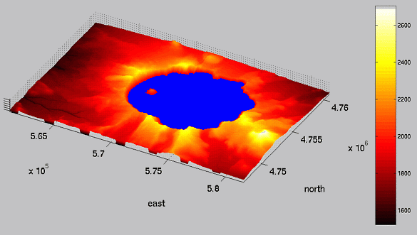
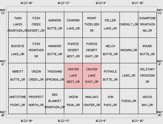
3-D topo map
|

Vicinity map
| Crater Lake
| 7.5 x 15 minute composite map of Crater Lake, Crater Lake NP, USA.
The incredibly deep (500+m), incredibly clear lake lies inside the collapsed caldera
of the former Mount Mazama, which erupted explosively 7700 years ago.
A must see!
|
|

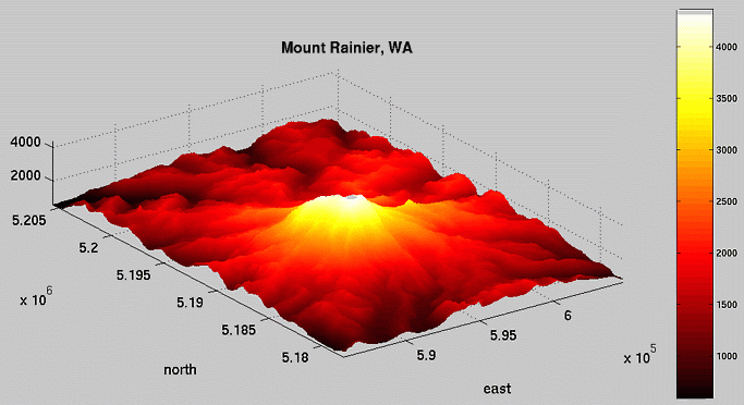
3-D topo map
|

Vicinity map
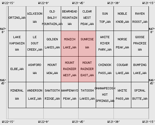
| Mount Rainier
| 15 x 15 minute composite map of the Mount Rainier area, Washington, USA.
At 14,410 feet (~4300m), Mount Rainier is among the highest peaks in the lower 48 states.
What sets it apart is the contrast. On a clear day you can see Rainier
from Seattle, and most terrain around the base is less than 5000 feet (~1500m) in
elevation. Many active glaciers reside on Rainier's slopes, making it a realistic
high-peak climbing situation. In many ways, Rainier is the crown jewel of the
Cascades Range volcanoes.
|
|

3-D topo map
|

Vicinity map
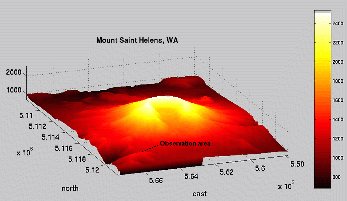
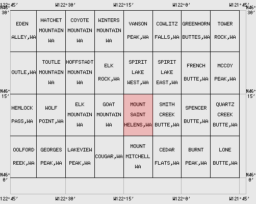
| Mount Saint Helens
| 7.5 minute map of the Mount Saint Helens area, Washington, USA.
This presumed-dormant volcano was about 3000m high before an erupion in May, 1980 vaporized the top 500m,
raining down ash over much of the northern hemisphere. The area is now a national monument, though
when I visited in 1992, the region was still a moonscape. I've heard vegetation is setting in,
however.
|
| | | | | | |
 Fun with Topographical maps