![[*]](http://sepwww.stanford.edu/latex2html/prev_gr.gif)


Next: REFERENCES
Up: Table of Contents
Blake Outer Ridge dataset
Sergey Fomel
sergey@sep.stanford.edu
ABSTRACT
Blake Outer Ridge dataset
|
Raw Data /data/2d_real/blake_outer_ridge/cmps-tp.HH
Velocity Model N/A
Stack N/A
Zero-offset Migration N/A
Usage AVO/methan hydrates: Ecker et al. (1997); Ecker and Lumley (1993, 1994); Ecker (1994, 1995, 1997, 1998); Matsumoto et al. (1996); Mora and Biondi (1999), imaging/velocity estimation Biondi and Sava (1999); Clapp and Biondi (1999); Fomel (1999); Sinha and Biondi (1999)
Geometry
  /data/2d_real/blake_outer_ridge/cmps-tp.HH: in="stdin" expands to
  in="stdin" esize=4 n1=625 n2=48 n3=1105 n4=1 33150000 elem 132600000
  bytes d1=0.004 d2=-0.1 d3=0.05 d4=1 Warning: d2 is negative. Legal,
  but risky.  o1=4 o2=3.825 o3=0 o4=0 label1=Time label2=Trace-record
  number label3=
Non-linear cable group spacing: 100 m at near offsets and 50 m at
far
offsets.
Problem N/A
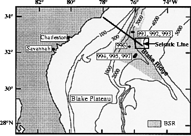
History of Data The data were recorded at the Blake Outer
Ridge, offshore Florida and Georgia. A map of the region is shown in
Figure 1, highlighting the area of known hydrate
distribution as mapped from seismic bottom simulating reflectors
(BSR). The part of the seismic line is marked by the rectangular,
and extends both from the hydrate region into an area without
hydrate. The data were provided by USGS (Keith Kvenvolden, Myung
Lee, and Bill Dillon).
Preprocessing N/A
Proprietary Considerations N/A
map2
Figure 1 Map of the region after
Matsumoto et al. (1996).
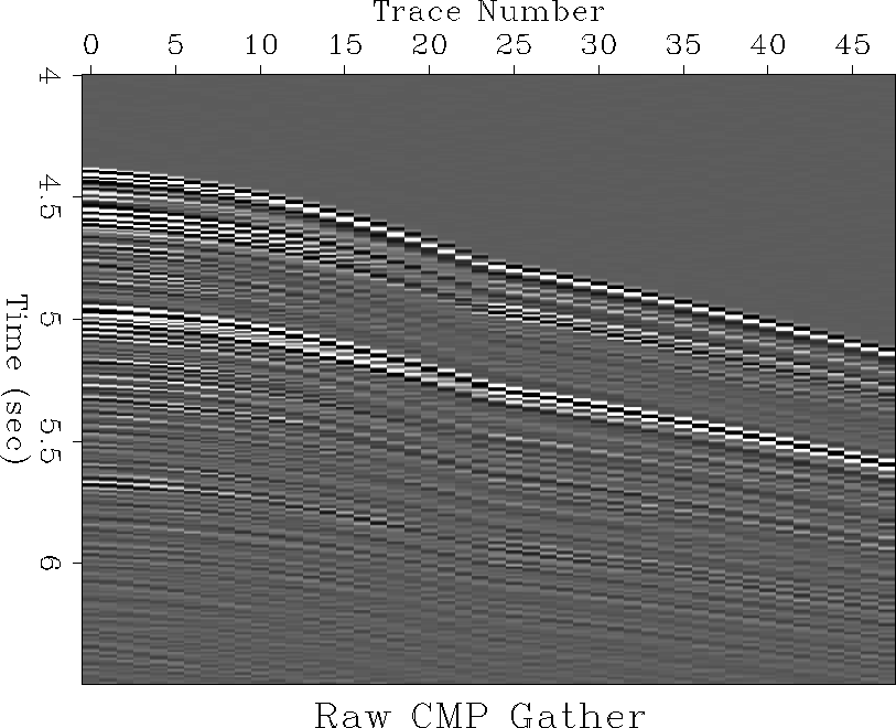
 cmp
cmp
Figure 2 CMP gather.


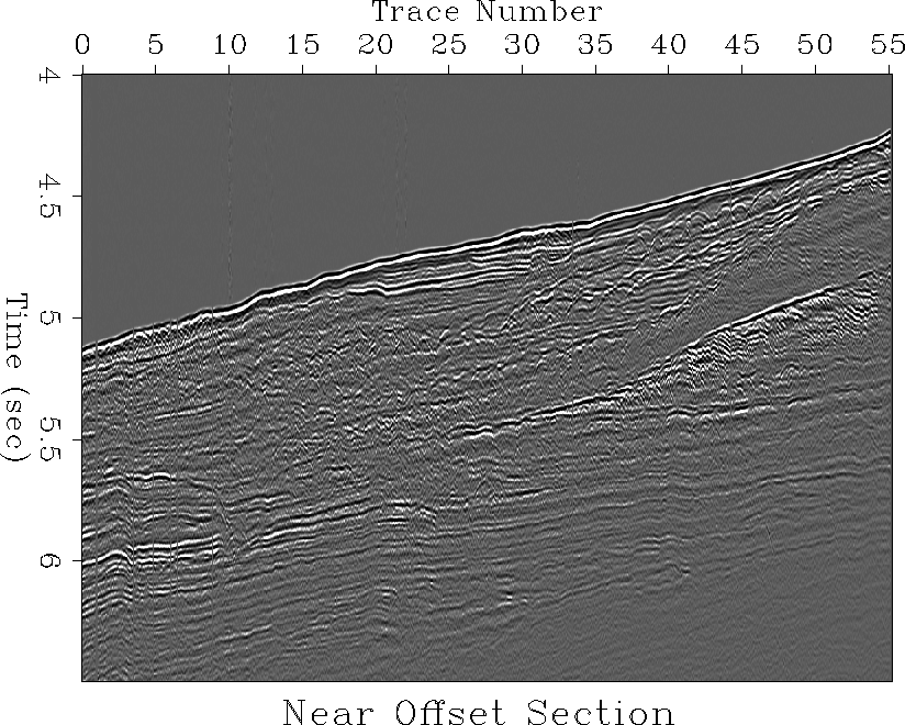
 nearoff
Figure 3 Near offset gather.
Next: REFERENCES
Up: Table of Contents
Stanford Exploration Project
1/15/2002