|
|
|
|
Least-squares reverse time migration for the Cascadia ocean-bottom dataset |
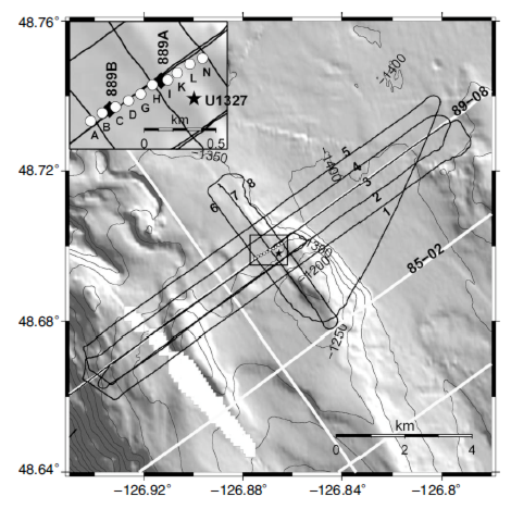
Next we present results of LSRTM on an OBS survey located at the northern Cascadia continental margin offshore of western Canada. The area is known to contain gas hydrates, which have a characteristic structure known as the bottom-simulating reflector (BSR), that marks the base of the hydrate stability zone. OBS data were collected along five parallel lines normal to the margin (Figure 4). Line spacing was 500 m with ten ocean-bottom seismometers deployed with 100 m spacing at a water depth of about 1300 m.
|
|---|
|
geo
Figure 4. The geometry of the Northern Cascadia dataset. Ten ocean-bottom seismometers were deployed with 100 m spacing at a water depth of 1300 m. The shot line spacing was 500 m. |
|
|
|
|
|
|
Least-squares reverse time migration for the Cascadia ocean-bottom dataset |