


![[*]](http://sepwww.stanford.edu/latex2html/cross_ref_motif.gif) :
the reflectivity on the left,
and the reference slowness on the right.
The model consists of several fractured horizontal reservoirs
which are in production. The reference slowness is smooth and
not conformant with the stratigraphy.
We assume that the reference slowness
:
the reflectivity on the left,
and the reference slowness on the right.
The model consists of several fractured horizontal reservoirs
which are in production. The reference slowness is smooth and
not conformant with the stratigraphy.
We assume that the reference slowness 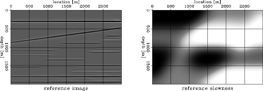 |


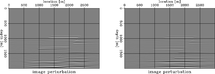
Figure shows the slowness perturbations
we introduce in the slowness model. For each of the two scenarios,
we generate data using the same reflectivity (Figure )
but different slowness models generated by adding the respective
slowness perturbations to the reference slowness.
We then image using the reference slowness to create repeat
survey images.
Finally, we subtract the reference image from each of these two images
and obtain the image perturbations (a.k.a. the 4-D seismic data)
depicted in Figure .
Figure enables us to make two observations:
).
In practice, this distinction is virtually impossible,
and the only place where we can extract reliable information
is at the top-most producing reservoir.
 |
We address the ambiguity of the 4-D interpretation using WEMVA.
Figure shows the slowness perturbations
obtained by the adjoint of the WEMVA operator ![]() in Equation () applied to the image perturbation
in Equation () applied to the image perturbation ![]() in Figure .
The two cases can be better distinguished now,
although the information is not yet localized at the
producing reservoirs.
in Figure .
The two cases can be better distinguished now,
although the information is not yet localized at the
producing reservoirs.
The least-squares inversion result,
shown in Figure , is much better focused at the
reservoirs. Despite the inherent vertical smearing mainly
caused by the limited data aperture, we can
precisely indicate the location of the producing reservoirs,
the sign of the slowness change, and even the relative magnitude
of the change from one reservoir to the other.