


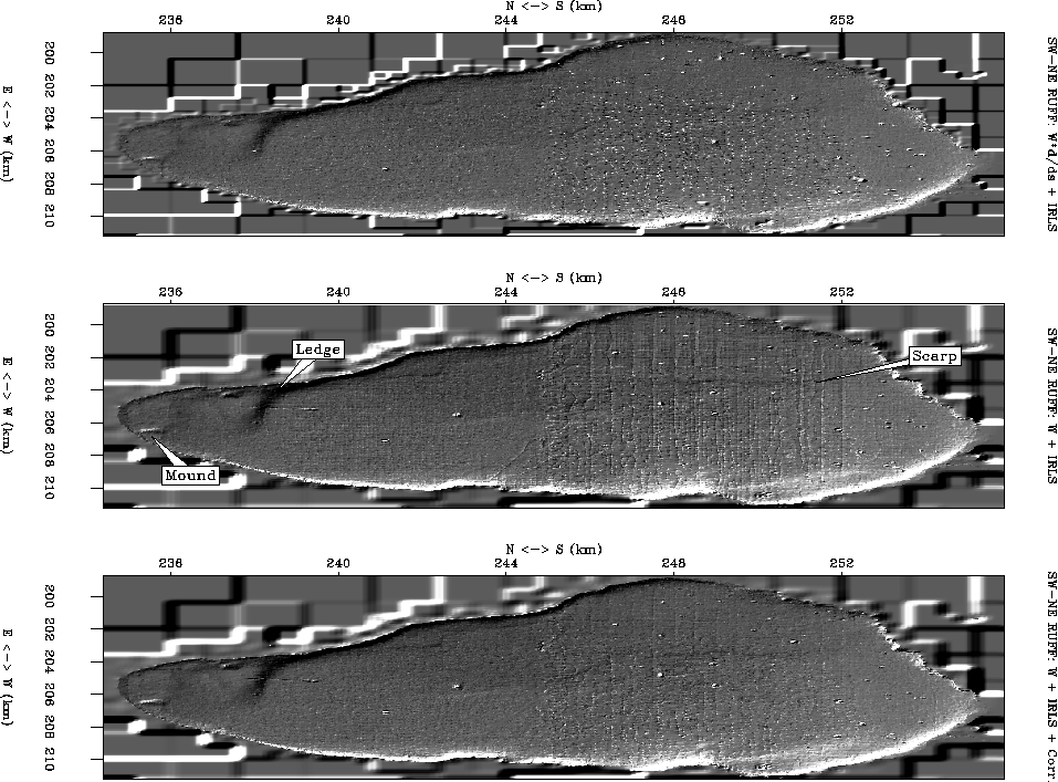
Figure 2 shows the final Galilee maps computed with the three discussed methods, and then roughened from southwest to northeast. The block-shaped artifacts on the periphery of the study area are due to the ``Quadtree Pyramid'' method used to generate a starting guess for the conjugate gradient iteration Brown (2000).
The result for system (3) in Figure 2 is free of the acquisition
footprint which plagues the center panel (system (2)), but obscured by seemingly random
noise. This noise is a result of track-end artifacts
which ``propagate'', even though we have applied a zero weight on both sides of track boundaries.
We could suppress the random noise by increasing ![]() , at the expense of resolution.
The right panel of Figure 2 shows the result using my approach. Track artifacts are
suppressed considerably, though not totally, compared to the center panel. The underlying geologic features
look just as well resolved as in the center panel.
, at the expense of resolution.
The right panel of Figure 2 shows the result using my approach. Track artifacts are
suppressed considerably, though not totally, compared to the center panel. The underlying geologic features
look just as well resolved as in the center panel.
 |
![[*]](http://sepwww.stanford.edu/latex2html/movie.gif)


Figure 3 shows the difference between final maps generated by each of the three methods discussed in this paper. The left panel shows the difference between system (3) and system (2). We see track artifacts, as well as geologic features (238km north, 205km east), which confirms that first derivative along the track added to system (3) has caused some loss of resolution. The center panel of Figure 3 is the difference between the system (3) map and the map generated by my approach. First, we notice again the same loss of geologic features as in the left panel. Interestingly, we see correlated differences that are not along tracks. This tells us that although both approaches lead to white residuals, as we will see in Figure 4, they do not produce identical maps. This question needs to be answered. The right panel of Figure 3 shows the difference between my approach and system (2). As expected, we see considerable differences along tracks, but little to no geologic differences. This tells us that my approach has maintained the resolution inherent in system (2), while doing a good job of suppressing acquisition footprint.
In the northern region of the map, we notice mainly negative differences along east-to-west tracks, and positive differences along north-to-south tracks. In the southern region, this relationship is reversed, and the differences are noticeably smaller. The spatial regularity in differences implies that the systematic errors may well be correlated in time and/or space. Unfortunately, we do not have the times at which the samples were collected. We only know that they were collected between 1986 and 1987.
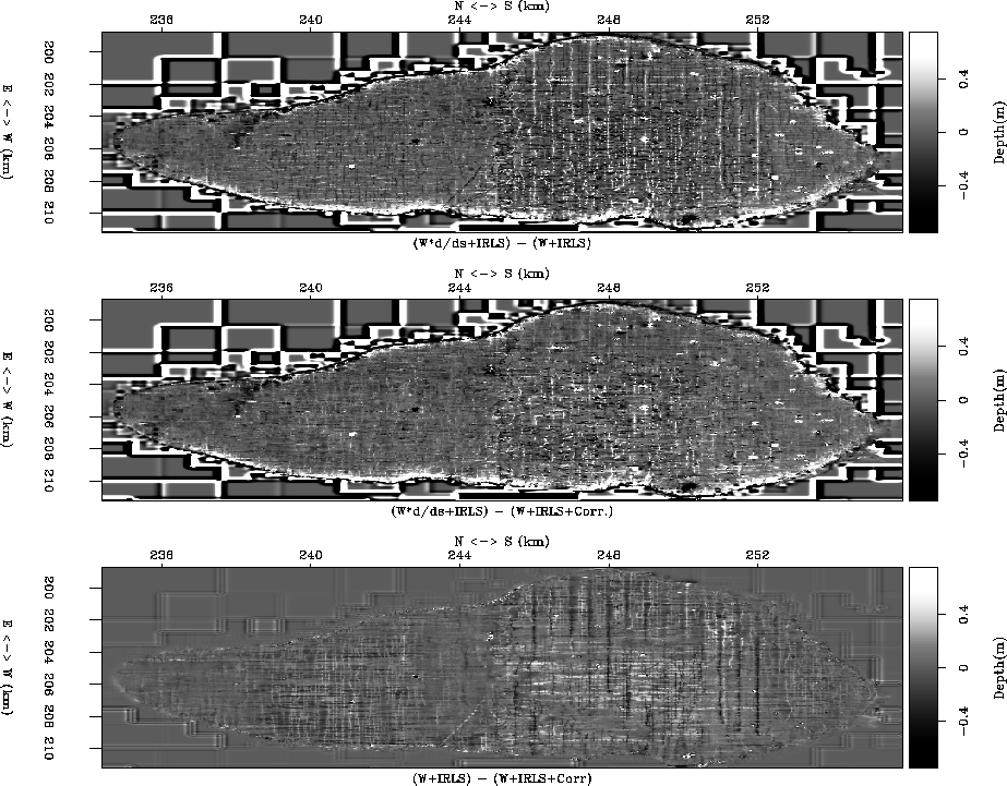 |
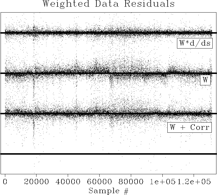
Figure 4 compares the data residuals for each of the three discussed methods. First, we see that IRLS alone (system (2)) produces a biased residual. The bias is most easily seen around sample 60,000 and sample 110,000. IRLS with track derivative (system (3)) produces an unbiased residual. On the bottom panel of Figure 4, we see that my approach leads to an effectively unbiased residual. Thus, from the viewpoint of optimization theory, my approach has achieved one half of the most important requirement of an optimal map: it is unbiased, although by inspection, not white. A better IRLS scheme should produce a more balanced, and hence white, residual for all three approaches.
 |